

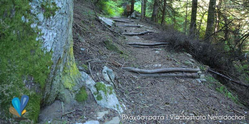
The area of the vlachostrata corresponds to the pastoral routes of the cattle breeders and their families, i.e. the tseligato, which start mainly from the interior of Thessaly to end up in the “property areas” that include the settlement and the summer pastures.
The vlachostrata is the spatio-temporal route around which the movement of herds is organized as part of an integrated management support system. Its material side includes cobblestones, bridges, overnight stops, etc. There are no central events that mark the collective arrival and departure of the herds. The local communities, returning to their mountain villages, organize their productive, social and cultural life, each centered on their village. The place of the chimadia corresponds to a time of waiting for the next ascent, but also to processes of transferring the intangible heritage.
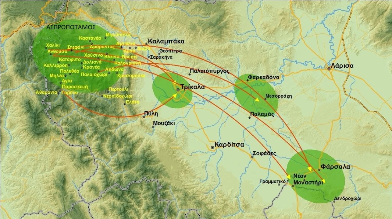
The vlachostrata is ultimately a sum of different routes depending on the geographical location of the valleys in the plain and the village in Aspropotamos. In general, based on the topography of the area, two entrances from the plain to the mountain can be found: the SE entrance via Pyli and the NE entrance via Sarakina.
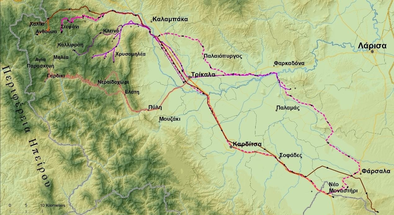
The 2 main herd movement routes are then presented:
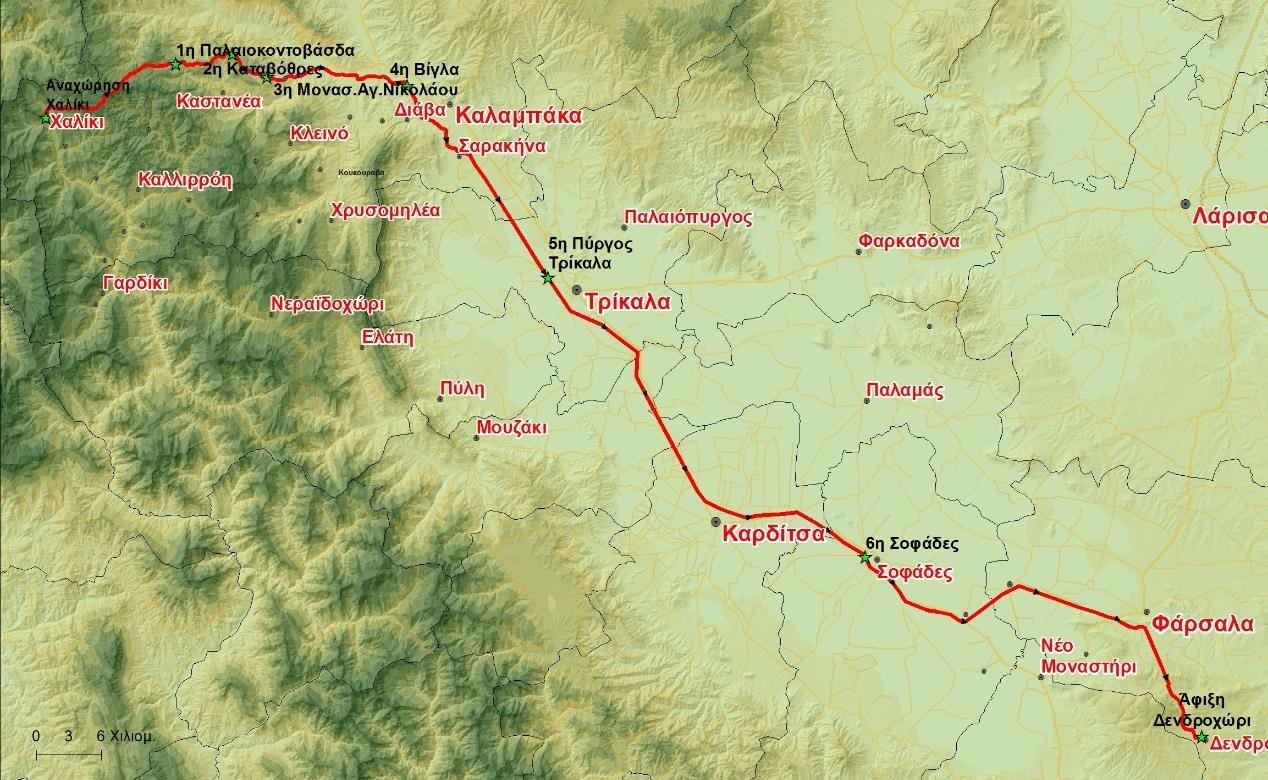
Cattle breeders used to move to Stefani Aspropotamou where during the winter months they are settled near the village of Vrysia Farsalon and the place Alogopati. The movement to Stefani took place in the middle of spring, from 10 to 15 May and their return, to the winter residence, at the end of October.
Until the 1950s, movement was done on foot, then the railway was used, and from 1970 until today, the animals are transported by trucks. About 100 families of breeders who raised sheep and cattle from the Farsala area moved to Stefani, Anthousa, Haliki and Agia Paraskevi.
The cattle breeders of the area of Stefani breed free-range cattle in the pastures of the village. The areas where the animals grazed were designated by the local Forestry Department. Until 1980, sheep were raised in the area, but then this activity was abandoned.
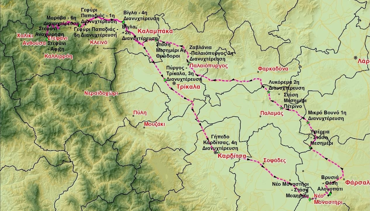
During the ascent from the plain of Farsala to Stefani, the distance they covered was approximately 145 kilometers and it took 8-10 days. The usual route they followed was:
1. Vrysia (Alogopati location), Farsala,
2. stop at noon in Yperia,
3. 1st night, at Mikro Vounos,
4. stop at noon in Petrino,
5. 2nd night, in Vlohos at Lykorema location
6. 3rd night, in Paleopyrgos (Zavlania),
7. stop at noon, in Theopetra and then we cross the bridge of Sarakina,
8. 4th night at Vigla place,
9. 5th evening, at the bridge of Papadia before Kastania,
10. 6th night, in the place of Murava,
11. Arrival in the village of Stefani.
In the places they chose to stop there was a place for grazing and sufficient water. In order to spend the night, they set up furkes (wood) and threw Vlach malins (wool fabric) over them.
During the summer season, in Stefani, they processed the milk at home and made caseri, feta and
Basque (type of cheese). Kasseri was made in cheese factories known as “kassarias”, where the herdsmen usually provided the drained curd called “baski” instead of milk.
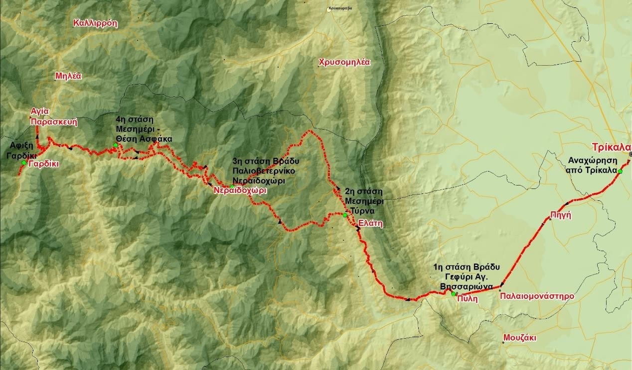
In autumn, during the descent from Stefani, the distance they covered on foot was 130 kilometers and it took 5 days because the small animals had grown and the transition was easier. The route they usually followed was:
1. Start of movement from the village of Stefani,
2. 1st night, at the bridge of Papadia after Kastania,
3. 2nd night, in Vigla place,
4. 3rd night, in Pyrgos outside Trikala (in the place where the animal market used to be),
5. 4th night, at the stadium of Karditsa (at the place where the animal market was held),
6. Stop at noon at Neo Monastiri,
7. Arrival in Vrysia of Farsala at Alogopati.
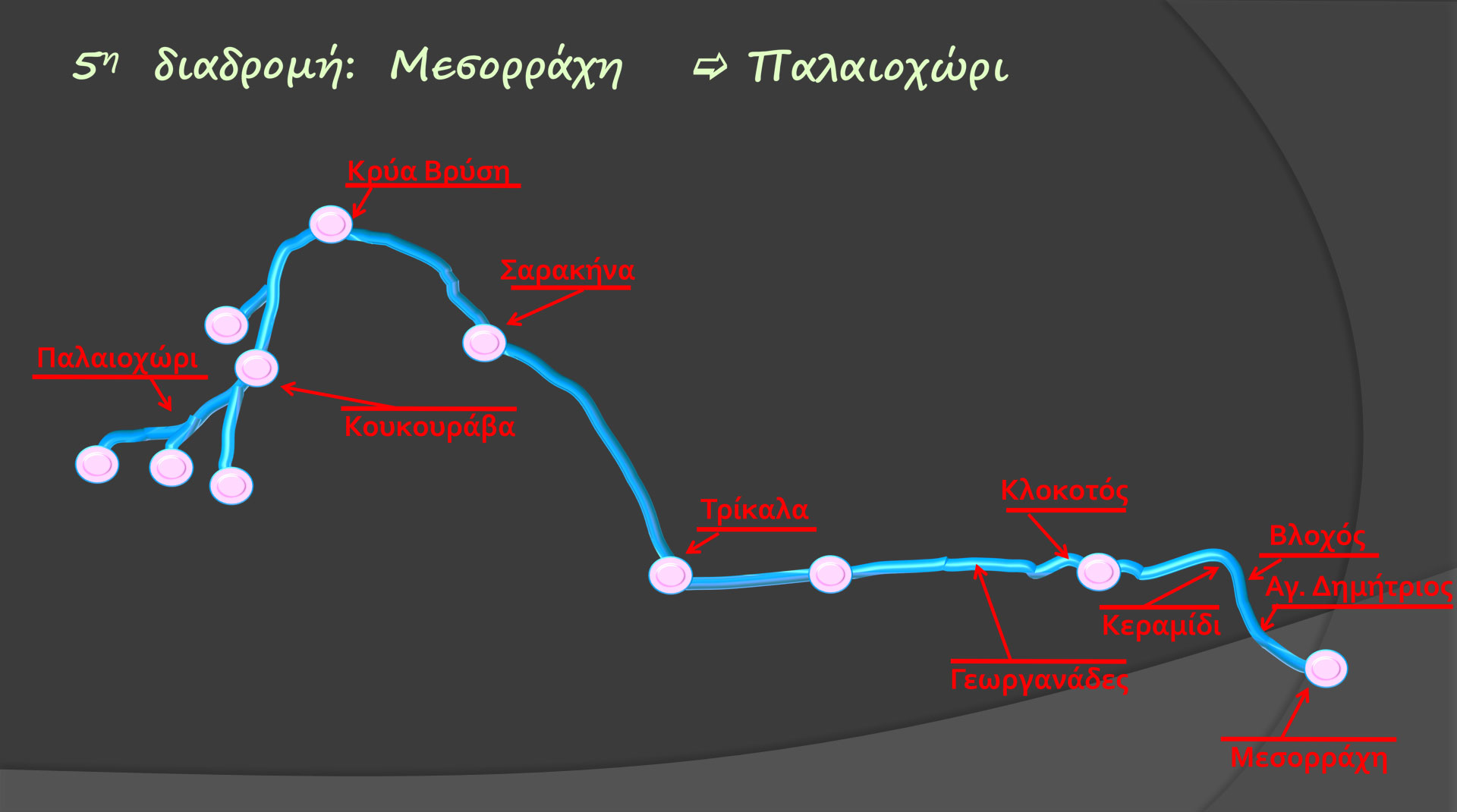
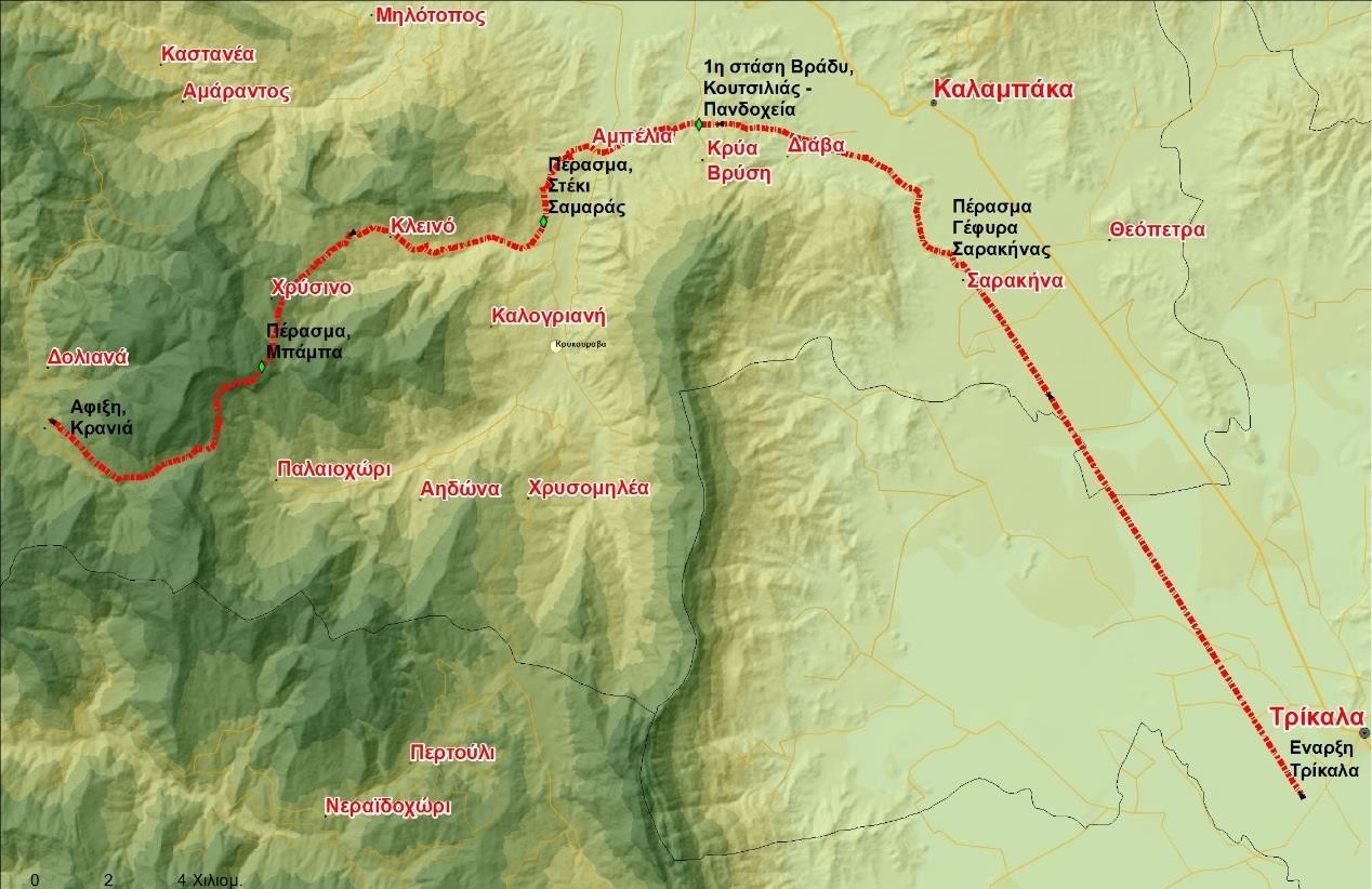
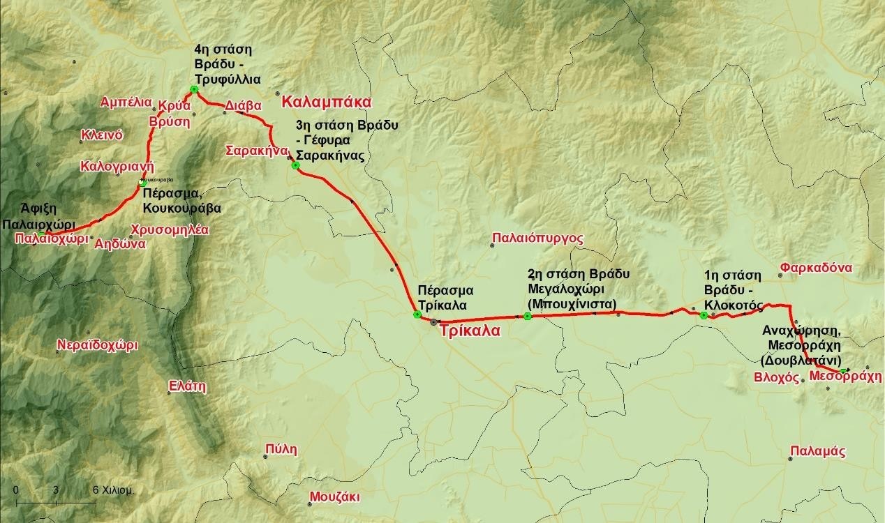
The distance of the Vlachostrata from Douvlatani (Messorachi) to Paleochori is about 82 kilometers. The herds crossed it in 5-6 days depending on the weather. Until 1988, Palaiochori kept about 2,500 goats and sheep, which wintered in addition to Douvlatani and Farsala.
In May, the route they followed for the mountains was:
1. Departure from Douvlatani, they passed outside the villages of Ag. Dimitrios – Vlochos and at Keramidi they crossed the Pinios River.
2. Then they followed the embankment to Klokotos where they spent the first night.
3. The next day they followed the road from the village of Georganades to Megalochori (Buhounitsa). Here was the second overnight stay.
4. Sarakina was the next overnight stop,
5. while the fourth overnight stay took place at Lakes near the village of Krya Vrysi.
6. The continuation of the route took place on the eastern bank of the Kleinovitikos river and the passage to the opposite bank took place at the Koukourava location (without a bridge) to end up in the village of Paleochori.
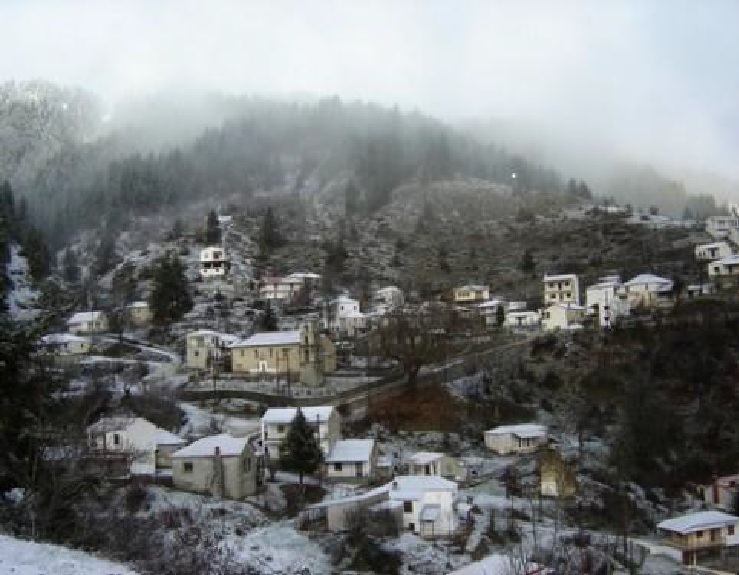
At about 1000 meters altitude, the area of Paleochori has wonderful meadows. In the village there was a water mill, a water saw and a water belt (they operated until 1960). The village once had many beehives with hives made of fir bark. Depending on the weather conditions, in October, they followed the same route, to return to the plains and to their winter residence (Messorachi).
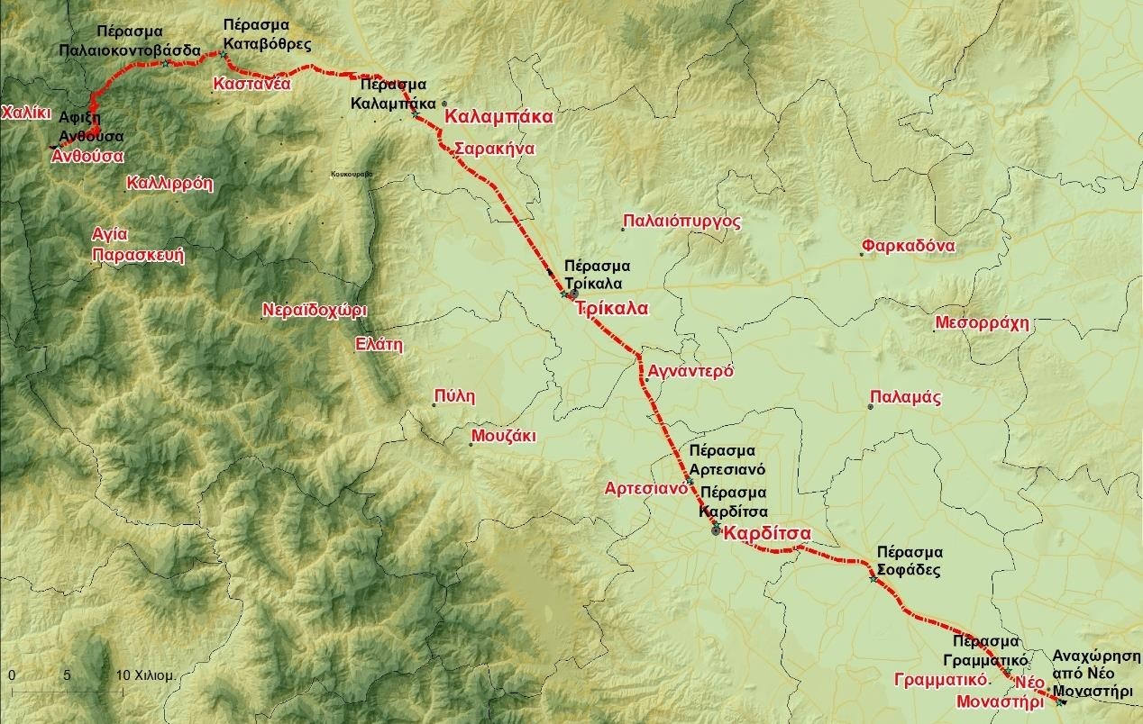
The six main movement routes of livestock farmers.